The Sawtooth fault in central Idaho was acknowledged as an active fault for many years, but little research was done on it. The tectonic activity of the region was then dramatically confirmed in 2020 when the Stanley earthquake rocked most of the northwest United States. In addition to bringing up new issues regarding fault behavior and the history of earthquakes in central Idaho, the earthquake sparked a wave of study that is illuminating the Sawtooth fault.
After the M6.9 Borah Peak earthquake in 1983, the M6.5 Stanley earthquake on March 31, 2020, was the second largest earthquake ever recorded in Idaho. The earthquake and its many aftershocks happened in the Centennial Tectonic Belt, which has been impacted by the region’s passage over the Yellowstone hotspot, even though they had nothing to do with Yellowstone. Like a bow wave of a boat, this seismicity zone encircles the hotspot.
Geologists and seismologists usually move swiftly to gather information that will aid in a better understanding of the occurrence following a powerful earthquake.
But the Stanley earthquake occurred right after a significant winter and early in the COVID-19 epidemic. Scientists found it challenging to perform fieldwork as a result. We have gained a lot of knowledge over the past four years, despite the poor start.
The complexity of the Stanley earthquake was underestimated. According to the earthquake’s location, the Sawtooth normal fault, which dips east, is where it originated. However, the focal mechanism pointed to a multi-fault, intricate rupture that was neither east dipping nor typical.
The geometry of the faults that caused the Stanley earthquake has been modeled in at least three distinct ways: two parallel faults, two faults that cross at an acute angle, and two faults that are perpendicular. All of the models describe a complex geometry, regardless of which is right.
All powerful tectonic earthquakes typically result in aftershocks. They usually happen as the crust adapts to new stresses after the energy release along the main shock’s fault plane.
To measure aftershocks that are still happening today in the Stanley area, scientists from the Idaho Geological Survey, Boise State University, and the U.S. Geological Survey were able to set up temporary seismometers (the bigger the earthquake, the longer the aftershocks survive).
An image of the fault plane is created by three-dimensionally mapping aftershocks. The complexity of this earthquake is further demonstrated by the Stanley aftershocks, which reveal a north-trending fault that dips sharply to the west, parallel to the Sawtooth fault but dipping in the opposite direction.
As is frequently the case with earthquakes of magnitude M6.5 and above, the surface was not ruptured. According to modeling and data on ground deformation, the fault movement that caused the earthquake ceased at a depth of roughly 10.6 miles.
The Stanley earthquake caused several rock falls, debris slides, and snow avalanches even though there was no surface fault rupture.
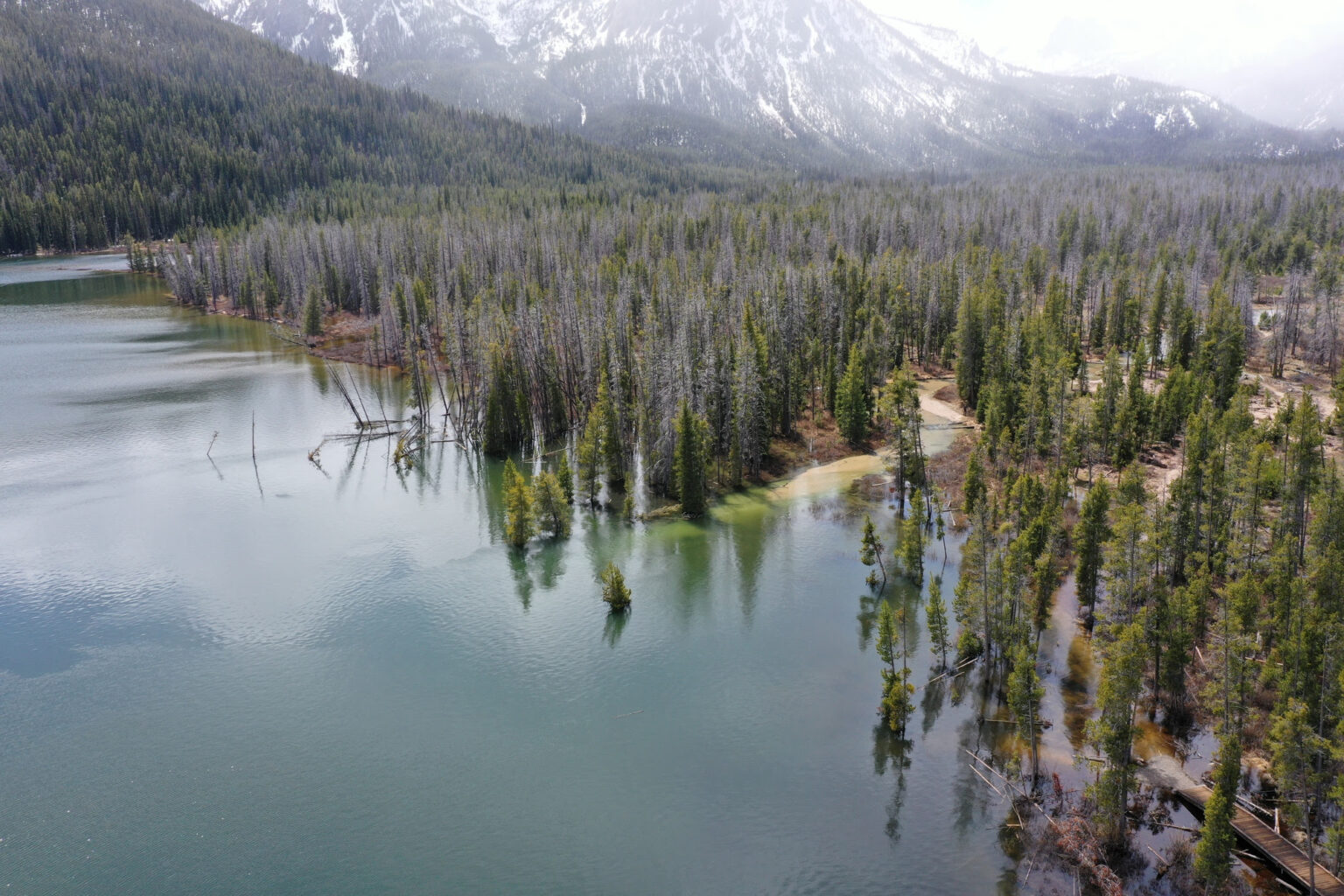
Liquefaction in Stanley Lake was one of the earthquake’s most striking impacts. Water-soaked, loose sediments may become weaker and behave more like liquids as a result of ground shaking.
Liquefaction caused the sandy area close to the inflow stream of Stanley Lake to drastically sink. Large fissures and sand boils developed along the shore, and a well-liked beach in the entrance stream delta vanished entirely.
The website of the Idaho Geological Survey has additional details about this liquefaction event: https://www.idahogeology.org/geologic-hazards/earthquake-hazards/stanley-lake-liquefaction.
Geologists were able to trace the Sawtooth fault in detail thanks to new lidar data that was collected soon after the earthquake. The generated map demonstrates that the Sawtooth fault is a discontinuous fault zone with many strands rather than a single continuous line.
Paleoseismic trenching locations were identified by researchers using detailed maps of the fault. In order to record and date sediments that have been moved by previous earthquakes, a trench must be dug across the fault. Geologists from the U.S. Geological Survey discovered evidence of at least one earthquake that occurred there about 9,000 years ago when they dug a trench over the northern Sawtooth fault.
In order to shed light on the history of earthquakes along other portions of the fault, more paleoseismic trenches are planned.
Lake data have also been used by researchers to study the history of the Sawtooth fault. Redfish Lake sediment cores contain evidence of two earthquakes that occurred along the principal Sawtooth fault 4,300 and 7,600 years ago.
Evidence of a single earthquake approximately 5,100 years ago that was different from the Redfish Lake earthquake episodes was preserved in lake sediment cores from Pettit Lake, which is located 15 kilometers to the south.
There are still many unanswered concerns regarding the Sawtooth fault and the Stanley earthquake despite all of these new discoveries.
Did the Sawtooth fault ever breach in a single earthquake, for instance? If not, how often have smaller earthquakes occurred on shorter segments? Are many strands ruptured simultaneously or at separate times by earthquakes on the northern portion of the fault?
Geologists are still conducting fieldwork and modeling to gain a better understanding of this significant and distinctive fault system in central Idaho.
GET THE HEADLINES FOR THE MORNING.
Note: Every piece of content is rigorously reviewed by our team of experienced writers and editors to ensure its accuracy. Our writers use credible sources and adhere to strict fact-checking protocols to verify all claims and data before publication. If an error is identified, we promptly correct it and strive for transparency in all updates, feel free to reach out to us via email. We appreciate your trust and support!


